Esta entrada fue actualizada el 22 de junio del 2014.
(This post was updated June 22nd, 2014.)
La Marta Wildlife Refuge -Historic site-
Pejibaye of Jiménez, Cartago
La belleza de las montañas que rodean el Refugio de Vida Silvestre La Marta
(The beauty of the mountains that surround La Marta Wildlife Refuge)
(The beauty of the mountains that surround La Marta Wildlife Refuge)
La Marta Wildlife Refuge is a protected area that is approximately 1518 hectares, located in Canton of Jiménez, Cartago.
It is surrounded by five rural communities whose main activities are subsistence farming and ranching.
It is also the gateway to the La Amistad National Park and Tapantí Death Massif, two of the 12 protected areas that make up the large block of territory incorporated into the Biosphere Reserve of Friendship and Natural World Heritage Site, international nominations awarded to the Talamanca Range by UNESCO.
The Refuge is managed by Castro Carazo Metropolitan University Foundation since 1991.
In La Marta farming began from 1895, in order to take advantage of the presence of the railroad that served the banana plantations in the Pejibaye River Valley. In 1928, the banana industry declined, and La Marta lost its agricultural importance and production stopped.
In 1990, the area was donated by its owners, a group of Americans, the Conservation International, an NGO nonprofit based in Washington, United States. This organization transfers ownership to the University of Science and Technology (ULACIT), as a contribution to the newly created Master of Ecotourism, which subsequently and in conjunction with the Ministry of Natural Resources, declared it A Private Wildlife Refuge.
The La Marta Wildlife Refuge has a rugged terrain at altitudes between 750 and 1.950 meters above the sea. The temperature fluctuates between 18 and 27 degrees Celsius. The relative humidity is high, averaging 90 %. Due to the temperate weather conditions (warm and altitudinal differences), explains the exuberance and remarkable biodiversity.
The water and geological wealth is of great importance. Inside the Refuge you can see a formidable fluvial system with rivers of fresh and clear water, waterfalls and ancient caves.
There is an impressive variety of fungi, ferns and lichens. Assorted species useful for food, dyes, chemicals and a variety of plants with medicinal properties. This opens great perspectives for scientific research in future benefit of mankind.
The flora and wildlife features correspond to tropical rainforest, with distinct Caribbean influence.
Approximately 40% of the territory is primary forest and the remaining 60 % is covered by secondary forest in various stages of natural regeneration.
The agricultural infrastructure that was developed in the late nineteenth century such as the coffee mill, the sugar cane mill, the sawmill, the dairy and the hydroelectric plant, can be observed today, are part of the attractions, as well as the incredible biodiversity of the area, that can be enriched by the historical tour and return to the past, all in one place. (Source: Universidad Metropolitana Castro Carazo)
The engineering works mentioned before are impressive, not only for the period in which they were built, but also for the high quality design, that maximizes the high hidric potential in the area.
-----------------------------------Click on the images to enlarge.
-----------------------------------
El Refugio de Vida Silvestre La Marta es un área protegida que mide aproximadamente 1518 Has, ubicada en el Cantón de Jiménez, provincia de Cartago.
Está rodeada por cinco comunidades campesinas cuyas actividades principales son la agricultura de subsistencia y la ganadería extensiva.
Es también la puerta de entrada a los Parques Nacionales La Amistad y Tapantí Macizo de la Muerte, dos de las 12 áreas protegidas que conforman el gran bloque de territorio incorporado a la Reserva de la Biosfera de la Amistad y Sitio de Patrimonio Mundial Natural, nominaciones internacionales otorgadas a la Cordillera de Talamanca por la UNESCO.
El Refugio es administrado por la Fundación Universidad Metropolitana Castro Carazo desde 1991.
En la Marta se iniciaron labores agrícolas a partir de 1895, con el fin de aprovechar la presencia del ferrocarril que servía a las plantaciones bananeras ubicadas en el Valle del Río Pejibaye. En 1928, al decaer la actividad bananera, La Marta perdió importancia agrícola y dejó de explotarse.
En el año 1990, el Área fue donada por sus propietarios, un grupo de norteamericanos, la Conservation International, organización no gubernamental sin fines de lucro, con sede en Washington, Estados Unidos. Esta Organización transfiere la propiedad a la Universidad Latinoamericana de Ciencia y Tecnología, ULACIT, como un aporte al recién creado programa de Maestría en Turismo Ecológico, la cual posteriormente y en conjunto con el Ministerio de Recursos Naturales, la declara Refugio Privado de Vida Silvestre.
El Refugio de Vida Silvestre La Marta tiene una topografía accidentada su altitud varía entre los 750 y los 1,950 metros sobre el nivel del mar. La temperatura fluctúa entre los 18 y los 27 grados centígrados. La humedad relativa del ambiente es alta, con un promedio de 90%. Por sus condiciones climáticas templado - cálidas y diferencias altitudinales se explica la exuberancia y la notable biodiversidad que posee.
La riqueza hídrica y geológica es de gran trascendencia. En el interior del Refugio se puede observar un formidable sistema fluvial con ríos de aguas frescas y cristalinas, cataratas y cavernas milenarias.
Existe una variedad impresionante de hongos, helechos y líquenes. Especies variadas de flora útiles para la alimentación, tinturas, productos químicos, y una gran variedad de plantas con propiedades medicinales. Esto abre grandes perspectivas para la investigación científica en beneficio futuro de la humanidad.
La flora y la fauna características corresponden al bosque tropical lluvioso, con clara influencia del Caribe.
Aproximadamente un 40% del territorio corresponde a bosque primario y el 60% restante está cubierto por bosque secundario en distintas etapas de regeneración natural.
Actualmente aún se observa la infraestructura agrícola que se desarrolló a finales del siglo XIX, entre ellos: el beneficio para el despulpe del café, el trapiche para el tratamiento de la caña de azúcar, el aserradero, la lechería, la planta hidroeléctrica, y mucho más, son parte de los atractivos agregados de La Marta tanto para que los visitantes además de conocer la increíble biodiversidad de la zona, pueda enriquecerse con el tour histórico, y volver al pasado, todo esto en un mismo lugar. (Fuente: Universidad Metropolitana Castro Carazo)
Las obras de ingeniería citadas anteriormente son impresionantes, no sólo por la época en la cual fueron construidas, sino también por la gran calidad de diseño para aprovechar al máximo el gran potencial hídrico de la zona.
----------------------------------
Haga click sobre las imágenes para agrandarlas.
-----------------------------------
Este es un mapa de como llegar al Refugio de Vida Silvestre La Marta.
(This is a map of how to get to La Marta Wildlife Refuge.)
La distancia entre San José y el Refugio de Vida Silvestre La Marta se muestra en la siguiente figura.
(The following figure shows the distance between San José and La Marta Wildlife Refuge.)
Localización del Refugio de Vida Silvestre La Marta según las hojas cartográficas.
(Location of the La Marta Wildlife Refuge according the the cartographic information.)
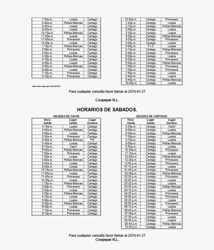
Información de transporte
(Transportation information)
Más información
(More information)
(Pejibaye River)
Información de transporte
(Transportation information)
Más información
(More information)
Algunas fotografías tomadas en la ruta hacia el Refugio de Vida Silvestre La Marta.
(Some photographs taken along the route to La Marta Wildlife Refuge.)
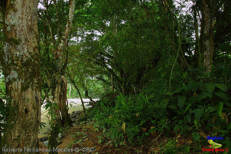
Río Pejibaye(Pejibaye River)
Pejibaye-Refugio de Vida Silvestre La Marta
(Pejibaye-La Marta Wildlife Refuge)
Refugio de Vida Silvestre La Marta
(La Marta Wildlife Refuge)

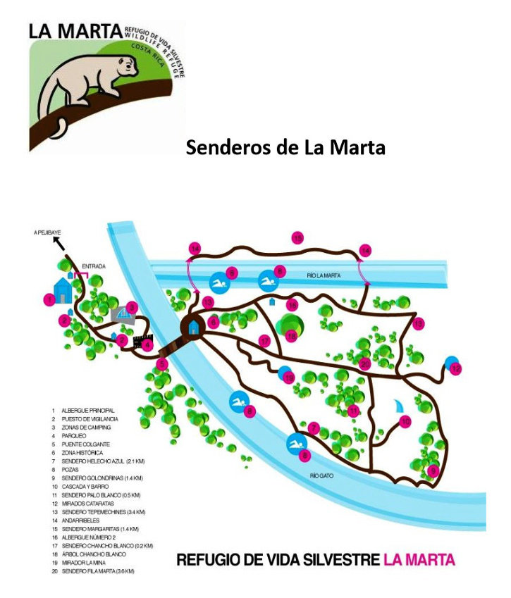
Fotografías tomadas entre el albergue principal y el estacionamiento
(Photographs taken between the main shelter and the parking area)
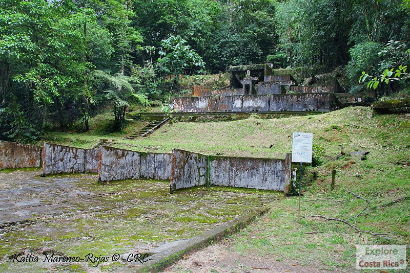
Sitio histórico
(Historic Site)

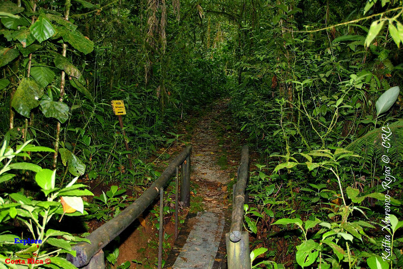
El acceso es a través de un puente que cruza el Río Gato
(The access is through a bridge that crosses the Río Gato)
Beneficio
(Coffee mill)
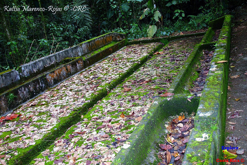
Canales
(Channels)
Establo de los burros
(Donkeys' stables)
Lechería
(Dairy)
Trapiche
(Sugar cane mill)
Las siguientes entradas de este blog están relacionadas con la actual:
(The following posts of this blog are related to the actual one:)
Más fotografías en Flickr -Explore Costa Rica-.
(More photographs on Flickr -Explore Costa Rica-.)
Conozca y cuide a Costa Rica. Es de todos nosotros!!
(Get to know and take care of Costa Rica. It belongs to all of us!!)


